Category Archives: Nature

Ajo Scenic Loop and BLM Land

Standard
IMG_4589

Afternoon sunlight on the Ajo Scenic Loop

When Coyote Sue told me about Ajo, I was excited to hear there was plenty of free camping on BLM land right outside of town. Between what Sue told me about Darby Well Road and the brief write up on the Free Campsites website, I found the BLM land with little problem.

IMG_4556

Beyond these two saguaros, one can see the giant wall of earth. Beyond the wall of earth is the New Cornelia Mine.

IMG_4557

“Property of Freeport Minerals Corporation–No Trespassing”

Freeport-McMoRan owns the land across from the BLM land.  Freeport-McMoRan’s land is fenced off, with “no trespassing” signs affixed to the fence. Beyond the fence, are massive walls of earth. Beyond the walls of earth is the New Cornelia Mine.

Later, when I read the brochure for the Ajo Scenic Loop, I realized that Darby Well Road is part of that picturesque 10 mile drive.

IMG_4672

This photo shows the view I had when I opened the side doors of the van.

The first couple of nights I stayed in the area, I kept my camp fairly close to Highway 85. On the third day, I drove the whole Scenic Loop and saw how much public land was available for camping. From that night on, I parked the van in a spot where I was surrounded by nature.

IMG_4591At the intersection of Darby Well Road and Scenic Loop Road is a sign warning people that smuggling and illegal immigration may happen in the area. I didn’t see anything that even vaguely resembled smuggling or illegal immigration, although I did see Border Patrol trucks zooming way too fast down Darby Well Road. The only other people I saw were boondocking on the BLM land.

Like on most BLM land, there is a 14 day camping limit here. However, there was no camp host in the area, and no IMG_4646permit was required for camping. I did not see any BLM employee during the time I  spent in there.

Camping in the Darby Well/Scenic Loop area is definitely primitive. There’s no running water, no drinking water, no picnic tables, no shade structures, no trash cans, no dumpsters, no showers, and no pit toilets. Nothing is provided and anything packed-in certainly needs to be packed-out.

This was the view from the other side of my van.

This was the view from the other side of my van.

What I liked best about camping on this BLM land is that even though Ajo is just a couple of miles away, I couldn’t hear the low roar of vehicular traffic in the distance. I couldn’t see the lights of the town. The only signs of civilization I saw were the RVs belonging to the other folks camping out and the occasional automobile tooling along Scenic Loop Road.

IMG_4631

This organ pipe cactus is visible from the Ajo Scenic Loop.

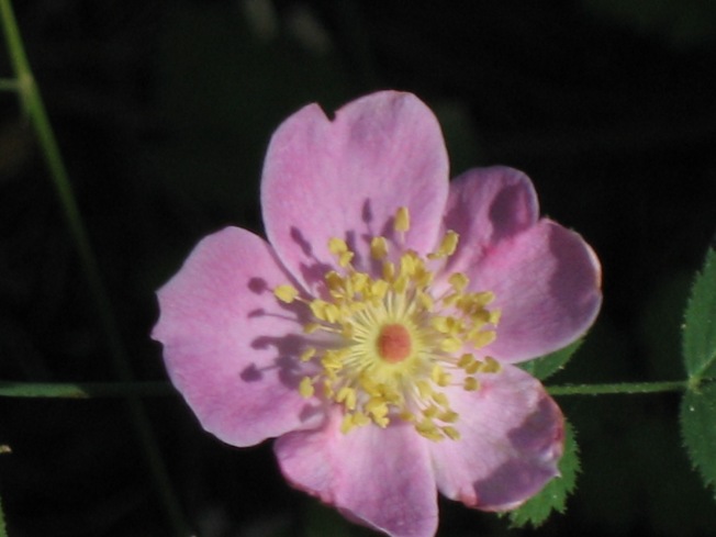
There is a lot of organ pipe cactus, as well as other varieties of cacti on the Ajo Scenic Loop. A brochure from the Ajo Historical Society Museum states,

Essentially all Sonoran Desert plants, for this elevation, are readily spotted on this easy self guided tour. Many say there are more Organ Pipe Cacti here than in the Organ Pipe Cactus National Monument. Saguaro, Organ Pipe, Hedgehog, Barrel, Prickly Pear and Cholla Cacti, Ocotillo and Jojoba, Mesquite, Iron Wood, Palo Verde and Elephant Trees, Fairy Duster and Brittlebush all are well represented or in abundance as are many more desert varieties.

[The overzealous capitalization in the above quote is thanks to the writer of the brochure and not to me.]

IMG_4742

Cholla–pronounced \ˈchȯi-yə\–cactus.

Saguaro in the afternoon light.

Saguaro in the afternoon light.

IMG_4649

The BLM land on the Ajo Scenic Loop is definitely one of my favorite places to boondock. It’s quiet, it’s dark at night, and the scenery is fantastic! IMG_4641

Trail of 100 Giants

Standard

IMG_3077The Trail of 100 Giants is interpretive trail located on the Western Divide Highway in the Sequoia National Forest.

IMG_3106According to a Forest Service website ,

Trail of 100 Giants is an easy, accessible walk through Long Meadow Grove, one of the premier groves of giant sequoias. The grove showcases monarchs estimated to be up to 1,500 years old. About 1.3 miles of paved trail offers several loop options with interpretive signs…This gentle trail (6% maximum grade) is paved and suitable for wheel chairs.

Trail of 100 Giants is part of the Sequoia National Monument. According to the previously mentioned website,

On April 15, 2000, President William J. Clinton proclaimed the establishment of the Giant Sequoia National Monument and made his announcement beneath one of the giant trees at the Trail of 100 Giants. IMG_3421

The grove contains approximately 125 giant sequoias greater than 10 feet in diameter and more than 700 giant sequoias less than 10 feet in diameter.  The largest tree in the grove has a diameter of 20 feet and is 220 feet in height.  The grove defined by the outermost giant sequoia trees covers 341 acres.  It is estimated that the ages of larger giant sequoia trees in the grove are up to 1,500 years old.

IMG_3123

Sometimes giant sequoias grow close to each other and fuse together, like the trees in this photo did.

I visited the Trail of 100 Giants during the summer of 2015. It is a magical, holy place. As the name of the trail implies, the visitor sees so many massive trees. I think it is difficult to comprehend the enormous scale of the trees from a photograph. Trust me, these trees are BIG, not just tall, but wide as well, with bark that is inches thick.

IMG_3101When I walked the trail, visitors were allowed to leave the path in order to get right up next to the trees, proving ample opportunities for tree hugging. (In the Sequoia National Park, the most famous trees–the General Sherman and the Sentinel Tree, for example–are fenced off to protect their root systems from the huge number of tourists.

IMG_3094Some of the trees on the Trail of 100 Giants have hollow trunks, allowing visitors to stand or sit inside the tree. It is absolutely magical to be able to exist within such an ancient living creature. One of my favorite trees is called the Goose Pen. A person can stand entirely within that tree and look up and see the sky through an opening in the trunk.

This is the view when standing in the Goose Pen tree and looking up.

This is the view when standing in the Goose Pen tree and looking up.

Of the many places I’ve visited, the Trail of 100 Giants is one of my favorites. I highly recommend it as a destination for tree huggers and nature lovers.

I took this photo while standing in the hollow trunk of a giant sequoia. The dark frame around the edges of the photo are the walls of the trunk of the tree I was standing in.

I took this photo while standing in the hollow trunk of a giant sequoia. The dark frame around the edges of the photo are the walls of the trunk of the tree I was standing in.

IMG_3081I took all of the photos in this post.

Deer Creek Grove

Standard

Deer Creek Grove is the southernmost grove of giant sequoias, “about 250 air miles south of northernmost Placer County Grove,” according to Dwight Willard’s excellent book A Guide to the Sequoia Groves of California. Willard goes on to say that the grove “…has about 35 mature sequoias strung along the creek, plus many younger trees. None are exceptionally large.”

Willard also explains that the grove was never logged for sequoias. “The grove was selectively logged for pine and fir only between 1914 and 1920, but has been preserved from cutting since then.”

The grove is in the Sequoia National Forest, near the small community of Pine Flat. It is a couple of miles from the California Hot Springs community.

I visited Deer Creek Grove early one morning when I was in the area in the summer of 2015.

IMG_3372

To get to the grove from Mountain Road 50, go straight (onto Mountain Road 56 toward Pine Flat) when Mountain Road 50 ends at Mountain Road 56. From Mountain Road 56, turn right when the road dead ends at Mountain Road 50. A sign labeled “Deer Creek Grove” will point you to a left turn onto forest road 23S04. Follow that winding gravel and dirt road for several miles, through ranch land, then forest. The road ends in a gravel parking area at the lower edge of the grove. When I visited, there was no sign, nothing other than the parking area and a dilapidated picnic table in a clearing to indicate that I had arrived.


Unlike other trails through (the admittedly few) sequoia groves I’ve visited, the trail through Deer Creek Grove is a real hike.

IMG_3197.JPG

The path is barely visible, marked only by other feet that traveled on it in the past. Some parts of the trail are on a somewhat steep incline. I thought I was in decent physical condition when I tried to hike through this grove, but I was soon huffing and puffing and panting as I ascended.

I wasn’t prepared for a real hike when I visited Deer Creek Grove. I was wearing a skirt when I really needed long pants to adequately protect my legs. I also really needed my walking stick to help me up the steep parts of the trail, but I’d left it in the van. I should have used a backpack to carry water instead of holding my bottle in my hands. I hadn’t been planning on mosquitoes either, but they were out in force, biting the hell out of me. The only bug repellent I had was some hippy dippy oily Tom’s of Maine stuff which made my skin greasy, but did absolutely zero to deter the mosquitoes.

IMG_3185

I didn’t stay in the grove very long. I didn’t hike the entire trail (which Willard says “…passes by all the grove’s good-sized trees”). I just wasn’t having much fun, so I decided to backtrack and leave. I did get a few nice photos before I left.

IMG_3189


IMG_3188

IMG_3191.JPG

IMG_3192

I took all photos in this post.


Dome Rock

Standard

This is Dome Rock, seen from a distance.

IMG_3397

According to http://www.summitpost.org/dome-rock-ca/153955, Dome Rock “is a 400′ high by 800′ wide granite monolith.” It is located on the Western Divide Highway, between Quaking Aspen campground and the Trail of 100 Giants. Dome Rock is located at the end of Forest Service Road 21S69, which is directly across from the Peppermint Work Center.

I’d heard of Dome Rock for several weeks before I visited it or even saw it from a distance. I wondered what the big deal was. It was just a rock, right? What’s so exciting about a rock?

The afternoon I visited, I drove down the short dirt road, excited to see something new.

The dirt road ends in a wide area for parking. I wasn’t sure how exactly to get to Dome Rock, but I saw a green gate with a sign on it.

IMG_3008

This is the sign I saw posted on the green gate.

I decided the rock must lie behind the gate. I walked behind it and headed up to the top of Dome Rock.

It’s not really a hike to the top of Dome Rock. I saw a faint trail and followed it up. The climb was a little steep, but not too difficult, even for an inside kid like me. The climb was absolutely nothing as intense as the climb to the top of Moro Rock in Sequoia National Park. (To read that story, go to http://www.rubbertrampartist.com/2015/08/02/i-climbed-it/.)

When I got to the top of Dome Rock, I realized the attraction is not the rock itself, but the view from the top of the rock. The view was amazing. Here’s a photo of mountains in the distance.

IMG_3021

Of course, the photos my little camera produces don’t really do justice to what in real life is a fantastic view.

Here’s a view of more mountains in the another direction.

IMG_3028

Are one of these peaks Mt. Whitney?

Mt. Whitney is apparently visible from the top of Dome Rock. According to Wikipedia, “Mount Whitney is the highest summit in the contiguous United States and the Sierra Nevada, with an elevation of 14,505 feet.”  I visited Dome Rock alone, so I had no one to point out Mt. Whitney to me. You’d think it would be easy to see the tallest mountain in the continental United States, but I didn’t see any mountain towering over all the rest.

Being on top of Dome Rock made me feel like I was on another planet. (I had that experience more than once in California.)

Dome Rock is so big that trees are growing on top of it.

IMG_3024     IMG_3010

IMG_3035

Pine tree on the top of Dome Rock.

Some of the trees on Dome Rock are dead.

IMG_3016     IMG_3022

IMG_3040

Someone had been up there stacking rocks.

IMG_3019     IMG_3017

Throwing rocks from Dome Rock is apparently a really bad idea. There’s another sign up there saying not to do it.

IMG_3026

The next photo shows that there are no guardrails around the edges of Dome Rock.

IMG_3023

See the edge there where it looks like the rock just ends? It really does! There’s no more earth on the other side of those rocks, just air and a loooooong drop.

According to a Forest Service informational brochure (which can be seen at https://fs.usda.gov/Internet/FSE_DOCUMENTS/fsbdev3_058930.pdf) visitors should “… be aware that there is no guard rail and the slope of the top of Dome Rock may be deceiving, with the drop to the bottom being hundreds of feet. Parents of young children should hold them securely while visiting the top.”

I scurried around the edge, wondering how close was too close. I suppose I didn’t get too close, as I didn’t plummet the hundreds of feet to the bottom.

It was very peaceful on the top of that rock. No other people where out there with me, and I didn’t hear a single sound produced by a human other than my own footsteps and breathing.

IMG_3388I didn’t stay on Dome Rock for very long. I hadn’t worn my hat, and the sun was beating down on my head. I enjoyed my visit and was glad to see a new outdoor attraction.

I took all the photos in this post.

South Creek Falls

Standard

IMG_2980I really like the way this warning sign basically says, “Cross the barrier and you WILL DIE!”.

However, the barrier is mostly psychological. Anyone could take a short stroll to where the fence ends and step right behind it. I guess that’s why the sign is so serious. IMG_2998

IMG_2988

The first time I saw the falls, the water was flowing fast and heavy. However, when I took these photos (in May or June of 2015), the flow had slowed quite a bit.

IMG_2992     IMG_2995


IMG_2999

This photo shows the view from South Creek Falls:

I took all the photos in this post.

Another Geologic Formation That Looks Like an Animal

Standard
This is Turtleback Mountain, as seen from Truth or Consequences, New Mexico.

I took this photo of Turtleback Mountain, as seen from Truth or Consequences, New Mexico.

Can you see the turtle? It’s on the right side of the mountain. Follow the red “wrong way” sign up, then slide your eyes just a little to the left. The “turtle” is lying on its belly, legs splayed.

This is not such a great photo. Here is a better one:


I bet you can really see that turtle now!

Here’s some information from that Sierra County website: Almost every visitor to Truth or Consequences hears mention of “the Turtle” or “Turtleback Mountain.” On maps, this mountain is usually indicated as “Caballo Cone” or “Turtle Mountain” but in T or C  [Truth or Consequences], you’d best call it “Turtleback Mountain” around locals — that’s their term for it and they are sticking to it!

I took the photos in this post.

Camel Rock

Standard

SDC10006

The Camel Rock is a rock formation located in Pojoaque, New Mexico on U.S. Routes 84/285. Tesuque is a little under twenty miles north of Santa Fe, and the Camel Rock formation is across from the Camel Rock Casino, which is owned by Tesuque Pueblo.

SDC10009

I’d passed by Camel Rock many times during trips between Taos, Santa Fe, and Albuquerque, but I never actually visited until I was driving a visitor to the airport in Albuquerque. We stopped for the briefest of visits. There’s not much to do out there besides look at the rock formation. There’s a small parking area with a couple shaded picnic tables and a couple trash barrels. There are no restrooms. (If you are in need of a restroom, go across the highway to the gas station or the casino.)

There is a path from the parking area to the formation. You can get pretty close to the Camel Rock to take photos, but since the rock formation is surrounded by a chain link fence, there’s no climbing on the camel.

The chain link fence is visible in the bottom third of this photo.

The chain link fence is visible in the bottom third of this photo.

The short detour off the highway was worth it to me to get some photos and so I could say that I’d actually been there, but the Camel Rock is clearly visible from the highway. Anyone driving or riding by in a passenger vehicle should be able to get a good look at it.

Trippin’ Tree

Standard

IMG_3054

I took this photo of (what I am pretty sure is) a sugar pine that grows on site #2 of my campground. Whenever I look at this tree, i could pretty much trip out if I let myself. This tree is very psychedelic. Something about those circles just gets my brain going, and I imagine them spinning, turning into faces, all kinds of wonderful crazy visuals.

A Few More Trees

Standard

If you haven’t seen enough giant sequoia trees in my last few posts, I will share a few more photos I took in the Sequoia National Park’s Giant Forest.

IMG_3273

These trees are called the Three Graces. They stand across and just down the way from the Giant Forest Museum.

IMG_3295

This tree grows near the path to the General Sherman tree. The large black area on the tree is a fire scar. The fire that left the scar may have happened hundreds or more than a thousand years ago.

IMG_3340

IMG_3275

This is a fallen giant sequoia tree through which a passage has been cut away. I walked through without having to stoop.

IMG_3345

I like the bumpy texture of this tree’s bark.

Giant Forest Museum and the Sentinel Tree

Standard

The shuttle I took from Visalia, CA to the Sequoia National Park dropped me and the other passengers at the Giant Forest Museum, so I decided to start my day there.

IMG_3269

This is the building which houses the Giant Forest Museum.

According to http://www.hikespeak.com/attractions/giant-forest-museum-sequoia/, “The rustic building that houses the museum was built in 1928 on a design by architect Gilbert Stanley Underwood.”

I think the museum is intended for people who don’t know anything about sequoias because the information presented seemed pretty basic to me. One exhibit I did find informative was the comparison of giant sequoias and coast redwoods to other trees and things like the Statue of Liberty and skyscrapers. I also enjoyed the pound of giant sequoia seeds in a large plastic jar. The sequoia seeds look so much like oat flakes that when I saw the jar, I thought Why did someone leave a jar of oatmeal there? Upon closer inspection, I realized I was actually looking at over 80,000 giant sequoia seeds.

According to http://www.fs.fed.us/database/feis/plants/tree/seqgig/all.html

The average number of cleaned giant sequoia seeds per pound
is approximately 81,000 (200,070/kg).

The Sentinel Tree stands outside the Giant Forest Museum.

IMG_3365

The Forest Service schtick for the Sentinel Tree is how average the tree is. The informational sign goes something like this: You think this tree is big, don’t you? In fact, it’s just an average size giant sequoia. It weighs more than two fully loaded jumbo jet airplanes–700 tons–but it’s just average! Ha!Ha! Tricked you! This tree’s not so big after all. There are bigger trees around here.

According to http://www.hikespeak.com/attractions/giant-forest-museum-sequoia/, the Sentinel Tree is about half the size of the General Sherman Tree.

There are two lines on the ground outside the Giant Forest Museum representing the Sentinel Tree. One shows how wide the base of the tree is, and the other shows how tall the tree is. By walking along the line representing the height of the tree, a person can pretend s/he is climbing the Sentinel Tree. Every twenty or so feet, there is a metal tile with a drawing showing the height represented and the width of the tree at that height. I was walking that line, metaphorically climbing the tree, when the rain started coming down hard, sending me into the Giant Forest Museum for the second time that day.

After the museum closed and I was waiting outside for the shuttle to pick me up for the ride back to Visalia, tourists started hopping the fence around the Sentinel Tree so they could have their picture taken with it. The older couple who’d been working at the gift shop in the museum tried to tell the first group (teenage boys) why they should stay off the tree’s side of the fence, but the mother of the boys was the one with the camera, and she would not be swayed from getting the photo she wanted. Later, as the photo family walked near me to get to their car, I heard them laughing at the improbability of their actions killing the tree. Humans can be so short-sighted while imagining their own specialness.

IMG_3268

The whole view of the Sentinel Tree.

All of the photos in this post were taken by me.

Read more about giant sequoias.